
(September 18, 2010)
Diablo Cyclist throwback Sierra Century--Plymouth-Slug Gulch-
Sutter Creek, 106 miles, 9380' climbing, 15.5mph.
w/ Ward, Todd*, Christine, Johnna, Carole*,
Sacto Cyclocross Racer*,
Dr. Dave*,
Sacto Doug, Laurie & Doug2 (aka Mr. Laurie),
Sacto Patti Smith Fan, Sacto Achtervolger (*first timers on 105 mile route, 95 miles, 80 miles, 60 miles) Ward-ograph
 The official Sierra Century (black route) started off going southwest down to the flatlands around Ione, and then went counterclockwise to Volcano and Fiddletown. Then a clockwise loop to Mt. Aukem and Slug Gulch--the feared climb of the day. If not timed out you could continue on the 120 mile course, clockwise, to Highway 88, and then back downhill to Fiddletown. We (orange route) cut out all the flatlands, and begin going north to Mt. Aukem and Slug Gulch. Then we go clockwise to Cook Station for lunch and then back downhill to Sutter Creek via Shake Ridge Road, go back up to Volcano, then down to Fiddletown.
  This blog report sponsored by Ward Industries Sundry Vending Division (Ward Industries Advertisement)
I'm rereading a book that got me through high school english every semester--Ball Four by Jim Bouton. Back then I really just remember the expose parts like Mantle hitting home runs with a hangover; now I'm picking up more nuisances. He writes how being scared is a great motivator:
"I love to pitch when I'm scared. Of all the big games I had to pitch in my life-I always did my best work when scared stiff." (35-36)
Maybe this is why the Sierra Century is so important to me. After a few times barely getting through the metric, and then recovering from injury, I signed up in 2003 for the 120 miler, and we scared shitless for months--which is a great training motivator. Some of the training included meeting Slug Gulch on a shorter version of the "backwards Sierra Century" we now do each year. I quickly found out that albeit no oh wow view, the Gold Country is GREAT for cycling.
***
1) The roads are well paved.
2) There is not much traffic.
3) There are not many traffic controls, maybe 3 stop signs for our 100 mile ride.
4) Loads of oak and pine forests in between small interesting towns.
5) Very little flat, usually roller after roller with some hard climbs thrown in.
6) Very few turns--our 100 mile ride has about two dozen.
7) Air is usually warmer and dryer than in the Bay Area.
I overcame my fear and loved the 2003 120 miler (10,000' climbing.) In 2004 my dad died a week before and I faded on the course but barely finished. Essentially riding solo was motivation to join a new bike club--the Diablo Cyclists, a great move. In 2005 probably had my greatest ride ever as we had a large Diablo Cyclist contingent that slammed through the course, synergistically getting energy from each other.
Alas this ended in 2006 when El Dorado County wouldn't give the Sacramento Wheelmen a permit so the course was rerouted along some crappy side roads, kept in Amador County low country, disaster struck when a cyclist was killed, and locals were up in arms as the route change has what little traffic exists all tied up. After that the Sierra Century was moved a few times with no similarities to the Gold Country route.
In 2007 & 2008 we ran a Diablo Cyclist metric century and a few people were real disappointed when the ride ended after 60 miles. So last year we made it a full century (with a metric turn off option at mile 50) and it worked out great, so after my broken shoulder fucking up this ride in May we rescheduled. Strange--must be first time since 2003 I was never in the Gold Country all year; in the past usually up here a half dozen times. But we got ride in and it turned out GREAT.
Prelude-drive up was a disaster, I was real anise--kept changing the CD's. Heavily overcast. Been semi-depressed anyway, the camp I worked at for three years during college is having a reunion so they have a site on Facebook where loads of photos are published. Great seeing the loads of photos from the mid 1970's--some people I thought were "ancient" were maybe close to 30. Conversely, see photos of some of the campers and counterculture counselors I worked with--lots are a bunch of OLD people, that look like my grandfather. I'm delusional--I think I'm 39 and so is everyone else I know (the age when "old" baseball players skills tarted to decline.") Looking at these present day photos of the high school/ college kids I worked with is a real kick in the pants. Coupled with this year going down the toilet, and the overhead fog just a general sense of foreboding.
Anyway we parked right outside the Amador Fairgrounds that has a bluegrass fest going on--Dr. Dave, Christine, Ward and I tried our best to wake up the sleeping campers in the other side of the chain link fence. Sacto Doug had sent out an email to his new club, and a half dozen folks showed up, including Laurie and Doug2 (aka Mr. Laurie), who are long distance tandem riders we met in the Davis 300k brevet. Poor Jack couldn't do the ride, he showed up different cycling shoes and his sense of fashion prevented him from wearing two different shoes--that and they both were for the left foot.
Plymouth to Pioneer Park via Shenandoah Wine Valley, Mt. Aukem (20 miles, 1879' climbing, 15.1 mph)
The public jailhouse/ restroom was still locked in Plymouth so a few of us sprinted across town to the gas station for a 3 mile prelude. It was still overcast and cold and we were riding into a real thick fog, on the only segment that has frequent vehicle traffic. On the rollers in the Shenandoah Wine Valley you couldn't see 20' in front of you. My M.O. for the first half of the ride would be to speed up to make sure the person in front knew where the next turn was, (and later set up for photos) then go to the back and ride with the achtervolgers. Ward would stay near the front and he knows the course well, so even though we had groups get unhooked here there was no problem.
We then hit the short Steiner Loop that at the top of the Shenandoah Valley--its an add on that Erma's Diner Bike Club once showed me. Like magic the fog lifted as soon as we hit the start of the loop (@mile 7) and it would be sunny for the rest of the day. Much better when we rode out on the assortment of baby and Italian (can't power over) rollers to Mt. Aukem. I knew where we were going but I had been away too long and couldn't estimate how long we had on a specific road before a turn--I should have taped the rest stop miles to the bike' stem. Diablo Cyclists were near the front along with a Sacto Team Revolution Cyclocross Racer, the rest of the Sacto Contingency was near the back, and I bs'd with Sacto Doug somewhere in the middle.
The rest stop is usually at a corner store in Fairplay, but people seem to enjoy Pioneer Park more, and unless someone needed something, most people bypassed the store and went right to the park. I give Doug a rash of shit as this is the place where he, Big Mike and Jack pushed on ahead in 2005 when I stopped for water--and I had to catch and pass their butts on Slug Gulch; I may not remember names of people I just met but I remember events.
 We park right outside the Amador County Fairgrounds, next to the bluegrass fest campers (sorry.) (Pumpkinpoto)
 Christine returns from the sprint across MODERN Plymouth complete with fine dining, as the bathroom in OLD TOWN Plymouth is still locked up. (Ward-o-photo)
  Carole rides through the gloom in the Shenandoah Valley vineyards. Much better ride if you can actually see the vineyards. (Ward-o-photo)
 Christine in a good mood though surrounded by fog. (Ward-o-photo)
 Like magic the fog starts to lift where the lead group waits for the achtervolgers before starting the Steiner Loop (Ward-o-photo)
 Ward Industries is fully diversified, and if you don't get a vending machine from them, you can probably call their animal control division. (Ward Industries Advertisement)
 Chairman Ward at a now fully sunny Fairplay before our first rest stop. (Pumpkinpoto)
 Our gruppo at Pioneer Park-Fairplay. Everyone is happy as no hard climbs.......yet. (Pumpkinpoto)
Pioneer Park-Omo Ranch via Slug Gulch (9 miles, 1,837' climbing, 10.3 mph)
At the first rest stop tried to describe the torture that was no waiting called Slug Gulch, but everyone looked stoked. Especially great riding with so many first timers who are now experiencing good roads with virtually no traffic and are jazzed. Dr. Dave finally gets to do this and has been listening to me as he is on his regular bike--this is not a recumbent friendly ride. Christine and Johnna stoked even though they don't need this ride to train for the Death Ride.
We immediately plunge into a heavily wooded area-Perry Creek Road, where after a few miles we'd make a sudden left turn--GEAR DOWN, and start the 4 mile Slug Gulch Climb. In reality most of the hard climbing is in the first 1/2 of the road, 4 tiers that start off as hard as the Mt. Diablo ramp, but each tier gets easier and easier. Its out in the open so best that we are doing it in the morning than in the afternoon as on the old Sierra Century. On this climb I go hard to get ahead of the group--I got so much crap in my pockets it will take me at least 2 minutes to dig out my camera.
 The pelaton on Perry Creek Road. (Ward-o-photo)
  Johnna and Laurie on Perry Creek Road. (Pumpkinpoto)
  Sudden left turn--and SLUG GULCH immediately begins. The shade will end soon. (Ward-o-photo)
 Ward Industries new logo for their non-kosher division. (Ward Industries Advertisement.)
 I'm enjoying Slug Gulch and Carole--maybe not. (Ward-o-Photo)
 Doug & Doug2 & Christine & Sacto Patti Smith fan on Slug Gulch. (Pumpkinpoto)
 Todd & the Climbing Doctor, Dr. Dave, on Slug Gulch (Pumpkinpoto)
 My training buddy, Ward, on Slug Gulch--I think he's humming "Horses, Horses." (Pumpkinpoto)
 The end of the Slug Gulch torture is near when the school signs appear. Well done. (Pumpkinpoto)
Omo Ranch to Cook Station (5'000' ele) via El Dorado National Forest (11 1/2 miles, 1664 climbing, 12.3 mph)***
Omo Ranch Indian Diggins School is one of the great rest stops of all time--nice big shaded lawn among the pines. On the old Sierra Century this is where they had wasing pools (none today) waiting for riders, and you either committed to more climbing/ the 120 mile route, or you went (or were sent if timed out) downhill on the 100 mile route.
***
After a nice long break we immediately started the 12 mile climb through the El Dorado National Forest--not nearly as steep as Slug Gulch. Usually this is a great 12 miles to race through (eg. 2005)--if Slug Gulch hasn't fully beaten you up (eg. 2004). Today, the pelaton rode together for the first third, I pushed the pace with cyclocross racer for the middle third, and then went back to account for everyone and rode in the back. When Ward got the pelaton to the next turn-Highway 88-he came back also.
***
Tremendous ride through the forest today. Sometimes there are deer hunters scurrying about, sometimes many ATV vehicles roling around the forest--today it was dead quiet. The slow pace at the end allowed for some peaks through the trees--found that many of the "oh wow" pine valley views are stuck behind the stands of trees and only allow a glimpse, even at slow speed.
At Highway 88 we do a bonus 1/2 mile uphill that the Sierra Century never did--we climb up past the 5,000' elevation sign (I'm really losing it, I thought it was 3,000' elevation) and go to Cooks Station--a cafe with a huge deck off to the side. This was lunch, which to me means a frozen fruit bar--Cliff Bar, and a soda. Most people ordered huge sandwiches and soon were trying to pawn half off or indicating that lunch was laying in their stomach during the next segment.
***
As we had been climbing all day, it was afternoon and we were only at the 40 mile mark. But not to worry--the nature of the course would drastically change and the course would be much faster.
 Even the Omo Ranch rest stop has Dr. Dave smiling--that and Slug Gulch is over. (Ward-o-photo)
 Sacto Doug explaining to his Sacto friends that Rice Krispie Treats would go good right now with cold water. ( Ward-o-photo)
  Tough group of women on this ride--Christine, Johnna, Carole and Laurie. Probably a dozen Death Rides between them. (Ward-o-photo)
 The pelaton starts up the El Dorado National Forest. (Ward-o-photo)
 Johnna enjoying the quiet of the El Dorado National Forest-(Ward-o-photo)
 Dr. Dave and Christine in the forest (Ward-o-photo with Pumpkincycle post production)
 Lunchtime at Cooks Station. (Pumpkinpoto)
 The chip girl cuter than any of those kids handing out ice cream bars on Carson Pass. (Pumpkinpoto)
Cooks Station to Sutter Creek via Shake Ridge Road. (25 miles, 906' climbing, 22.9 mph)***
After a long lunch stop we gathered around Highway 88, pointed our bikes downhill, and zoomed down a few miles. Usually there is a large traffic break on Highway 88, a camper must be holding traffic back somewhere, and we can reach the portion with the shoulder soon enough. Then is a sudden right turn on Shake Ridge Road, which is a continual downhill puncuated by a few Italian (serious) rollers.
***
At mile 50 we pass the intersection of the Fiddletown Expressway, and here is where we say goodbye to the metric riders who have a straight shot back to Plymouth. We continue on--and though we stay on Shake Ridge all the way down to Sutter Creek it awkardly turns twice whereas you think you're on another road.
***
Up and over Daffodil Hill--we've missed the daffodils by 6 months. Past the Charleston Road intersection, the hardest climb I know of. Past Hale (aka Hell) Road, the ill fated potholed strewn road with a stream involved in the 2006 edition. Fast downhill with some more Italian rollers right before Sutter Creek. We kept pretty well together on this stretch, and I noticed that it was getting warm which meant for most folks it was probably hot. Ride had gone from being a very slow affair where you could easily go 20mph. All of a sudden in Sutter Creek, one of the best looking Gold Rush towns--right out of the old west.
***
The heat and gotten to Doug2, and he, Lori, and Doug decided to take the backwater route back to Plymouth. I have to find out the directions from them, as one wrong turn usually puts one on a gravel road. Meanwhile we took a break at the secret bathrooms (great uncrowded extra stop on the old Sierra Century,) and tried to scare Carole, telling her about the wicked climb coming up--which was the 50' hill out of the parking lot.
 At the Fiddletown/ Shake Ridge intersection we say goodbye to the 60 milers. I'm ready to get going. I'd love a summer cabin up here. (Ward-o-photo)
 I'm with Doug on Shake Ridge Road -- at least in the photo (Ward-o-photo with Pumpkinpoto post production editing)
 Regroup at the secret bathrooms in Sutter Creek. (Pumpkinpoto)
Sutter Creek to Volcano (12 1/2 miles, 1035' elevation gain, 14.4 mph)***
This is one of the great climbs of all time. Usually shaded (at least in the morning), usually a tailwind. Today we had neither. But it is a gradual grade for the first 9 miles whereas it feels like magnet is pulling you to Volcano--with a stream running alongside.
***
Ward, Dr. Dave, Christine, Johnna, Carole, Todd and Sacto Cyclocross Racer start up together and then I start a hard effort. Soon Sacto Cyclocross racer and I are off the front--and I figure if we can fly to Volcano I can set up for photos of the arriving pelaton. Sacto Cyclocross Racer was riding with an earbud, which bugged Ward a little, but it was only one and he turned out to be a good guy. I had plenty of time to get in the shade of the Greek Theatre!! in this mini-town before the pelaton arrived.
***
Ward and Dr. Dave found the town library--a box of books left on the picnic table next to the general store. Only two ways out of town--Rams Horn Grade--an annoying climb, or Charleston Grade--the hardest climb I know of with three 1/8-1/4 sections as steep or steeper than the Mt. Diablo ramp. No takers for Charleston which was good as I'm tapering for next weeks Knoxville Double. So Ram's Horn it would be.
 The pelaton arrived in Volcano (Pumpkinpoto)
 Ward and Dr. Dave have some time for culture in front of the Greek Theater. (Pumpkinpoto)
 What a doimestique Christine is. She will be carrying extra water bottles up the next climb for all of us. (Ward-o-photo)
 Ward and Johnna getting some shade by the Volcano General Store. (Pumpkinpoto)
***
Volcano to Plymouth, Up Rams Horn Grade and Down the Fiddletown Expressway (16 1/2 miles, 1518' climbing--mostly during first 5 miles, 16.2 mph)
***
This segment starts off climbing Rams Horn Grade, a 3 mile climb which used to strike fear in the metric riders but is MUCH easier than Slug Gulch. MUCH. It's annoying as when you think the climb ends the grade keeps a slow uphill for about another 2 miles.
***
Finally we are at the Fiddletown Intersection and I get everyones "E-Ticket" for my favorite downhill. Cyclocross Racer goes first, I wait to make sure everyone is OK from the Rams Horn climb and then follow down in the back and stay in the back during the first steep downhill part. All of a sudden rollers and I start cranking. I hear Dr. Dave say "I thought this was all downhill"--but I love the short uphills puncuating the descent. I go to the front of Christine follows--though going 30 mph there is no way we'll catch Sacramento Cyclocross Racer. Near the end the rollers lessen and the descending sun is blinding through the trees--Christine goes to the front. Ward gets back to us and he'd easily take a sprint into Fiddletown but--SURPRISE--Fiddletown which usually is a ghost town has a special event going on complete with a street band and the road is blocked.
***
Dancin' fools Sara and Beth missed a great ride--especially when some lady asked Ward and I if we wanted to dance as we passed by.
 Barn leaving Volcano towards Rams Horn. (Pumpkinpoto)
 Christine up Rams Horn Grade (Pumpkinpoto)
 Todd, Ward, Carole and Christine before starting the Fiddletown Expressway. (Pumpkinpoto)
 (above) Ward and Todd & (below) Johnna arrive in Fiddletown--looking at the Rivendell Cycling Clothes hanging off to the side (Pumpkinpoto)
 Lady in Rivendell Cycling Cap who wanted to know if we wanted to dance (Pumpkinpoto)
 Todd in Fiddletown (Pumpkinpoto)
Fiddletown to Plymouth via the Ostrum Climb and Shenendoah Valley (11 miles, 558' climbing, 16.3 mph)
***
There is a flat shortcut back to Plymouth and Dave was worried that he'd miss the Tiny Tim Tribute Band at the bluegrass fest, so he took the shortcut. The other folks followed me to the LAST CLIMB on Ostrum Road, which is a series of short but steep climbs among the vineyards. OK, it's not ONE last climb but its all on ONE road. I felt great so I hammered on ahead to get some ending photos with the vineyards in the back--unfortunately the road and hence the riders were fully shade.
***
We were then back in the Shenendoah Valley, we could now see the vineyards and plant nurseries that were fogged in when we started the ride. We all stayed together on the downhill rollers. SUDDENLY--this great ride was over.
 I need practice taking photos while riding like Ward does. I think I'm yelling "hold still." (Ward-o-photo)
 (September 18, 2010) Diablo Cyclist throwback Sierra Century--Plymouth-Slug Gulch-Sutter Creek, 106 miles, 9380' climbing, 15.5mph.
 We park right outside the Amador County Fairgrounds, next to the bluegrass fest campers (sorry.) (Pumpkinpoto)
 Christine returns from the sprint across MODERN Plymouth complete with fine dining, as the bathroom in OLD TOWN Plymouth is still locked up. (Ward-o-photo)
  Carole rides through the gloom in the Shenandoah Valley vineyards. Much better ride if you can actually see the vineyards. (Ward-o-photo)
 Christine in a good mood though surrounded by fog. (Ward-o-photo)
 Like magic the fog starts to lift where the lead group waits for the achtervolgers before starting the Steiner Loop (Ward-o-photo)
 Ward Industries is fully diversified, and if you don't get a vending machine from them, you can probably call their animal control division. (Ward Industries Advertisement)
 Chairman Ward at a now fully sunny Fairplay before our first rest stop. (Pumpkinpoto)
 Our gruppo at Pioneer Park-Fairplay. Everyone is happy as no hard climbs.......yet. (Pumpkinpoto)
 The pelaton on Perry Creek Road. (Ward-o-photo)
  Johnna and Laurie on Perry Creek Road. (Pumpkinpoto)
  Sudden left turn--and SLUG GULCH immediately begins. The shade will end soon. (Ward-o-photo)
 Ward Industries new logo for their non-kosher division. (Ward Industries Advertisement.)
 The end of the Slug Gulch torture is near when the school signs appear. Well done. (Pumpkinpoto)
 Even the Omo Ranch rest stop has Dr. Dave smiling--that and Slug Gulch is over. (Ward-o-photo)
 Sacto Doug explaining to his Sacto friends that Rice Krispie Treats would go good right now with cold water. ( Ward-o-photo)
  Tough group of women on this ride--Christine, Johnna, Carole and Laurie. Probably a dozen Death Rides between them. (Ward-o-photo)
 The pelaton starts up the El Dorado National Forest. (Ward-o-photo)
 Johnna enjoying the quiet of the El Dorado National Forest-(Ward-o-photo)
 Dr. Dave and Christine in the forest (Ward-o-photo with Pumpkincycle post production)
 Lunchtime at Cooks Station. (Pumpkinpoto)
 The chip girl cuter than any of those kids handing out ice cream bars on Carson Pass. (Pumpkinpoto)
 At the Fiddletown/ Shake Ridge intersection we say goodbye to the 60 milers. I'm ready to get going. I'd love a summer cabin up here. (Ward-o-photo)
 I'm with Doug on Shake Ridge Road -- at least in the photo (Ward-o-photo with Pumpkinpoto post production editing)
 Regroup at the secret bathrooms in Sutter Creek. (Pumpkinpoto)
 The pelaton arrived in Volcano (Pumpkinpoto)
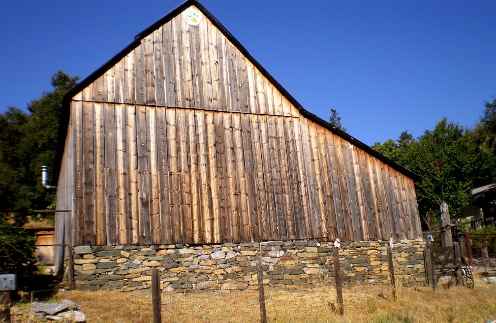 Barn leaving Volcano towards Rams Horn. (Pumpkinpoto)
 Todd in Fiddletown (Pumpkinpoto)
 I need practice taking photos while riding like Ward does. I think I'm yelling "hold still." (Ward-o-photo)
 Johnna on Ostrom Road (Pumpkinpoto)
 (above) Todd and (below) Ward and Christine at the end of Ostrum Road--NO MORE CLIMBING (Pumpkinpoto)
 Yep--above unedited-I gotta pack for Knoxville.
1 comment:
That is an AMAZINGLY detailed ride report. I might be able to do the ride, and might be able to document it like this, but both? Way too much.
Post a Comment