(July 24, 2010)
Tunitas Creek Metric Loop with Alpine Road climb add on. Jack and I full century,
Diablo Cyclists metric loop, 99 miles,
minimally 8,000' climbing, (
Tunitas Creek 6,100' climbing and Alpine Road alone is another 1,900'.)

Tunitas Creek elevation gain (last year from Ward), with orange line at end a Frederic Church fictional account based on reality of the bonus miles.
Prequel-I think the first time I did the Tunitas Creek loop was in 2002. I had heard about this legendary loop with lots of climbing, but as I never did a climbing ride before my knee injury I always avoided it. After a year of rehab, and being pissed that I has passed on so many "hard" rides, in 2002 our bike club met up with some really strong local riders (Three Musketeers) who were perfect guides for the ride. But when I showed up our club president greeted me with "I'm glad you're here so I wouldn't be last on the climbs."
And climbs there were. Almost immediately we were on the first climb, Old La Honda (3.3 miles, 1,260') and I was soon dead. What the hell was I going to do on the Stage Road double peaked prelude (5 miles, 700') and then Tunitas Creek (7 miles, 2,000'.) Luckily the San Mateo group waited patiently for us at the top and pulled the paceline all the way down speedy rustic Highway 84 through La Honda (no Ken Kesey sighting.) We did the loop "backwards," heading to San Gregorio instead of Pescadero, the Stage Road climbs where we finished by seeing the 20' Machine Gun Man skeleton in someones front yard. The locals then took as 10 mile side trip down Highway 1 and the Pigeon Point Lighthouse while I recuperated along with other slow riders at lunch in Pescadero.
We were then told that we did the loop backwards as there was an art fest on Tunitas Creek so we WOULDN'T be doing that climb (yippee, great) INSTEAD, we'd be leaving the coastal area and going back inland over Alpine Road (6.8 miles, 1,900') which was "just a little harder." (oh shit)
We left Pescadero and rolled by the house with the 1000 plastic pink flamingos. Back inland it was getting warm. Alpine Road was a bitch, and a few times I passed the club president who would quickly repass me as he always did. But it got very hot, especially on the last third were the trees kinda disappear, and when I passed the club president I stayed ahead of him on a climb for the first time ever. But some sudden steep grades were a bitch. Again the San Mateo group waited for us at intermediate rest stops, offered encouragement, riding tips, etc. I was soooo happy when my odometer showed close to 6o miles and the ride was virtually over, but was also real happy that I had finished, though half dead, the Tunitas Creek Loop.
Since that time I must have done the Tunitas Creek Loop at least a dozen times. The Diablo Cyclists always add the Pigeon Point Lighthouse loop along the Coast. It was my first ride when my Lightspeed was finally built (with just Big Mike), and a famous Diablo Cyclist Tunitas Creek ride was when a heat wave hit the Bay Area and it was 95 degrees on the usually foggy Coast (it was 115 degrees back in the East Bay.) I like the Tunitas Creek climb; the overall grade is deceiving as it starts off and ends shallow; the middle section is loaded with many killer hairpin sections. It is also well shaded, and now, has a good layer of pavement. With the Pigeon Point add-on its a 65 mile, 6,100' loop.
As a lead in to the Mt. Tam Double I wanted to get a century in--but was not sure where to add the miles. I then came up with a crazy idea, after doing the Tunitas Creek climb I could double back to La Honda and do the Alpine Road climb--which I had only done the once in 2002 on my first Tunitas Creek ride. This would be great, as I could see how my climbing was when I was tired, and there are numerous places along the Tunitas Creek Loop that someone tries to animated the pelaton. As the week went on I was sky high to do this. My only hesitation was my fondness for getting lost--but luckily I found some route sheets on the web detailing how to get back to Woodside from Alpine Road.
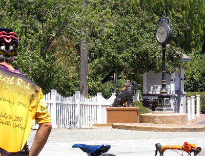
 Start behind the Pioneer Hotel in Woodside--very foggy/ overcast here inland which doesn't bode well for our ride out the the Coast where it should get even foggier and more overcast. At least wasn't cold--just bleak.
We had a mediocre club turnout for this seminal ride--a few people unwinding after the Death Ride. Luckily Joe and Ward just came back from business trips and were here, and the many of mystery--Rusty, showed up with his friend Gavin, which meant attacks all day whenever the road straightened out or on downhills as both are maniac descenders. A forecast for good training.
 Joe came back from a business trip to Brazil and was invigorated, and Ward came back from Texas, and was anti invigorated. Photo above is either of a Texan or a Brazilian, I forget.
We rode leisurely to the Old La Honda climb, much shorter than Tunitas Creek but harder for me as it is usually foggy so my breathing is f'd and there is almost no chance to warm up. A guy who hitched a ride on the back of our group to the climb took off at the base, so Joe and I followed and then shot off when the road got steep. Joe slowed so we could bs, and we must have passed two dozen cyclists-though two "kids" on Cervelo's, in Cervelo kits, also were bs'ing but spun right past us. I stayed on their wheel for about 1/4 mile but then gave up the ghost and they spun away easily. Damn. (To pharaphrase Lawrence Ritter's comparison of the two great mid century pitchers Dizzy Dean and Carl Hubbell, 'Dean remembered every game he ever won, and Hubbell remembered every game he ever lost.' I'd be stuck remembering the two Cervelo guys.)
Old La Honda on the way down is twisty and narrow, so I took off before the whole Club regrouped at the top of Skyline as I'm one of the slower descenders. Joe said he'd lead a group down NEW La Honda/ rustic Highway 84, which is a straight shot down--and I hoped to do it later in the day on my bonus miles.
 Old La Honda descent, you can see the road continue downhill across the valley.
 Regrouping at the Highway 84 (background)/ Old La Honda (part of road barely seen to the left.) Rusty the happiest in the group as he is wearing an orange jersey.
After we were all together we started down the super fast rollers (always with tailwind) on Highway 84 to and past La Honda. Everyone was flying--with Belgium champ Sara
starting the festivities. I'm much better on slow course than fast ones, so I just sat in back of Jim which assured me that we'd be with any lead group. A little past La Honda we made the sudden left hand turn (everything is sudden when going 30 mph) which started a series of uphills on
Pescadero Road. Great climb except that we almost got gassed by Meg Whitman's passing election caravan of
Porsches,
Ferraris and
Lamborghinis. Joe and I made a mistake, taking it easy on the climb so we only
summited a little before Rusty and Gavin-the latter flying by no hands on the downhill. At that point I vowed to go up hard on the climbs so downhill maniac passing wouldn't happen again. After the downhill starts to level off it is still a fast shaded road where we always have someone in our group fly by the first rest stop--the Memorial Park campgrounds. Sara didn't disappoint, she kept the tradition intact, so Rusty took off after her.
 Joe after the Pescadero Road turnoff from the Old La Honda Speedway.
 Ward thinking about taking a business trip to Brazil instead of Texas
.
 I'm happy that the sun is out and we are climbing again. My new helmet doesn't have nearly enough orange in it. (Photo by Ward)
 Jim among the redwoods in Memorial Park rest area.
We started towards
Pescadero, the road would slow a little with scattered uphill rollers thrown in. We kept a big
paceline, with Jim, Ward and I, the three riders clad in a new
Diablo Cyclist jersey, doing most of the work. A little before
Pescadero we detoured away from it on the
Cloverdale and Bean Hollow back roads to do a loop to the ocean and the Pigeon Point Lighthouse. Todd went to the front on the flat part--suddenly there were some sharp rollers and even sharper downhills and all hell broke loose, which got my dander up. Left in the back coming off a steep roller I motored to the front and Vic, Gavin and I raced to the Coast--a potential sprint was avoided when we spotted Rusty and Sara 100' ahead making the turn up Highway 1 and we decided to sneak up behind them.
 Taken during a rolling regroup before we start the back road loop via the Ocean to Pescadero.
Joined back with Rusty and Sara another cooperative
paceline along Highway 1 up the Coast--thought its too
fn foggy and overcast to stop and get a photo near the lighthouse. We turn in to take a few rollers and it quickly clears up just 1/4 mile off the Coast. Again a few attacks so it is time to motor over the rollers.
 Main Street Pescadero---The Country Bakery picnic area is where we always take lunch even though there is always some talk of split pea soup down the street. (Photo by Ward)
 Pescadero fine dining.
 Sarah dressed in Belgium colors on my team until she took off the vest and was wearing a Swiss kit underneath.
 Pelaton ready to roll--hills the rest of the way--hmmmm, anyone eat a really big lunch?Pescadero
 has a fun picnic area behind a store with made to order sandwiches, baked goods...as the rest of the ride is climbing I try to eat light here. But I get a bad case of brain freeze when I slowly fill up my water bottles (fill cap and pour, fill cap and pour) from a spigot 2" off the floor when there is another one in the picnic area a few feet off the ground. Then I get a banana and carrot muffin, not noticing that the muffin is wrapped in plastic as it has layers and layers of frosting on the top. The muffin is a mess and I try to eat around the frosting; a good chunk of cream lands on my shorts. Sara declares that "I must be happy to see her" (I am--in the Belgium vest.) Jack talks about doing bonus miles up the Coast to Half Moon Bay, but is is so overcast and depressing near the water that I tell him that I'm in for bonus miles, but want to do the Alpine Road climb where it will be warmer.
Only flat portion for the remainder of the ride--about a mile roll out to Stage Road. Looking forward to seeing the seminal folk art--the 20'
rebar skeleton holding a machine gun. But it went the way of the house with the 1000 pink flamingos--and now it was was gone too. (Who would YOU rather have as a neighbor--one with 1000 pink flamings or a
skeleton statue holding a machine gun.) Stage Road is a double peaked climb, perhaps each 2km, that ends in a twisty descent, and I wanted to be on the descent without being passed by the calvary, so I started up hard--Joe with me and we started bsing until the pelaton started closing in, and then we took off. I'm happy to say that none of the crazy downhillers passed me on the descent to San Gregorio.
 Joe cycling past the San Gregorio general store. With old club this used to be a rest stop but I don't think the Diablo Cyclists have ever stopped here.
 Rusty stopping to regroup with Sara.
Another short (1k?) but steeper climb back to the Coast--I rode up at Jim's pace as Gavin and Rusty behind waiting for Sara who slowed down when she jumped to the Swiss squad. Another fast descent on Highway 1--at least its a straight shot. The rest of the Club (except for Joe--he went AWOL) waiting to regroup after the turn onto Tunitas Creek Road.
 At foot of Tunitas Creek road where we regroup--looking West--Jack closest to camera with tall trees next to Highway 1 and the Pacific Ocean beach.
 From the view of Tunitas Creek Road looking East, where we'll be heading--Todd closest to the camera with Vic doing yoga. (Photo by Ward)
 The pelaton is back together and starts up Tunitas Creek Road. (photo by Ward)AN EDITORIAL
Fuckin Antioch Animal Control--they want you to go to Tunitas Creek and get a rooster--makes a great backyard pet.
My stupidass backyard neighbor has rooster--wonderful if you like hearing a constant half hour of yodeling at 5:30am. Contra Costa County Animal Control would investigate the law violation
416-12.202 Animal Noise--No person shall own, possess, harbor, control or keep on any premises, and ... fowl, ... that barks, bays, cries, howls, or makes any other noise so continuously or incessantly as to unreasonably disturb the peach or quiet of any two persons living in different households within 300 feet of the location of the disturbance.
Unfortunately cheapass Antioch opted out of the country animal control system and run their own--which means they're underfunded and do nothing. Their response to my complaint--peopel can have 10 fowl in their yards and if I think they're making too much noise call the police or file a suit. The police are dramatically undermanned and say its an animal control problem.
Soooo, when we passed by this everyone thought chicken/ rooster sightings were funny. Toto--are we in Antioch?
(1st photo Ward's composite, 2nd is mine)
 A new addition at the beginning of Tunitas Creek road.
Tunitas Creek Road starts off a a slight grade (less than 2%), stays about 3-5% for the rest of the first quarter, kicks up significantly in the middle, and returns to a slight grade for the last quarter. Jim goes hard at the beginning and leaps from the pelaton, and I just stay with him. With climbing bonus miles coming up might as well take it easy. When we hit the middle section Jim falls off and Jack comes by so I ride his pace--until he stops for a cyclist with a flat and no tire iron. I ride easily until Ward comes by, I ride with him for awhile but after 1/2 mile I tell him I'm going to circle back downhill for Jack. I start to but Rusty is coming up fast, so I do a full circle and fall behind Rusty and Ward. Rusty is fun to ride with but he'll easily get my dander up. Through the remains of the steep section Rusty, Ward and I are just bsing through the narrow heavily tree lined road. The road starts to flatten out and Rusty suddenly launches an attack, he can put out alot of watts and is quickly down the road but I slowly reel him back, and by the time I pass him I'm going full steam to the end. Thanks to Coach Rusty doing fun intervals.
***
I start locking up at the Skyline regroup so I start spinning easily in the direction "I think" gets me back to La Honda, when Jack soon comes along, indicating he knows the route I want to ride, which is nice following him instead of constantly looking at a route sheet. We ride a few miles in mostky downhill rollers when we get to the Skyline/ Highway 84 intersection--where we find Alice's Resturant, surrounded by more motorcycles than we ever see on Mines Road Junction Cafe. Stop to refill our water bottles as we need full ones going up Alpine Road. Then its down fast Highway 84--the way Joe went this morning, and the fast deje vu rollers to La Honda. Many less cars than in the morning and going at a fast but not 'balls out' pace. Then it is the sudden left but instead of going right into Sam McDowell County Park we go left and are at the start of Alpine Road.
 Alice's Resturant--I had never seen it as I've always descended rustic OLD La Honda road about a mile away..
Alpine Road is very similar to Tunitas Creek Road. Its well paved, heavily shaded (well at least the first two-thirds), and not much motor traffic. In fact less traffic than Tunitas Creek and all the turns have center stripes
. It also starts off with a gradual grade--I was thinking "is this the killer climb from 2002?" but it soon morphs into a road with killer hairpins. The climb was fine; Jack wasn't having as much fun as me so I let him set the pace. Jack on well shaded Lower Alpine Road.
 View back towards the Coast--look at that fog.
 Jack on upper Alpine Road that loses much of the tree cover.
 Stanford and East Bay from Page Mill Road.
Two thirds of the way up there is a clearing at Portola State Park/ Pescadero Creek County Park
(seems like central-west San Mateo is one big park). Much of the tree cover disappears; you can see the road continue to go up. Now it definately is warmer, many great views, and the climb is a steady grade (but not killer.)
***
We recross Skyline and in retrospect I should have continued along the ridgetop on Skyline. But, per the instructions I downloaded we continued down Page Mill Road. Jack warned me it was twisty, and steep in parts. Here Jack has much more fun than me--especially when I suddenly came upon two surprise haripin turns. Jack was waiting for me at the turnoff at Arastradero Road--by this time I was so screwed up I would have turned right instead of the left we needed to make. Some more semi rustic uphill (thank you jesus) riding through Arastradero Regional Preserve, which lead back into Alpine Road (somewhere a mudslide had closed part of Alpine Road), and Portola--where suddenly things looked familiar when we passed the start of the 1st climb of the day--Old La Honda.
***
100 miles and Tunitas Creek and Alpine Road in the same day. Great ride.
 Ward-o-meter of todays event. Like how in compressed version Calaveras looks tough--in reality (or if this page was 144" wide) it looks more like Foothill.
 Part of the Diablo Cyclist pelaton thinking about bonus miles to Calaveras. Comeon people--the Cinderella is 208 days away.

 Views from Calavaras Road.
 Jack on "the Wall"
 For there we continued down Niles Canyon Road--which does have alot of traffic and the beginning sets out with no shoulder. Making matters worse the slight downhill usually has a headwind. After a few miles, and the sudden right hand turn, we were on the Palomaras Climb--ride open road but well shaded and a creek runs alongside. Not close to a torturous climb but definitely we were now on one.
 Coming off Palomares, where we kept a high speed paceline where it flattens out (but again the miracle of slight downhill and tailwind) Jack turned right and Ward and I turned left to do some climbing along Redwood Road. Another rustic road smack in the middle of the urban center--not many cars or cyclists today--just the occasional motorcycle thinking they were on the autobahn.
 Good Samaritan Ward helps woman with flat tire and takes photo for tourists in Sunol wanting a photo with the mayor.
 For there we continued down Niles Canyon Road--which does have alot of traffic and the beginning sets out with no shoulder. Making matters worse the slight downhill usually has a headwind. After a few miles, and the sudden right hand turn, we were on the Palomaras Climb--ride open road but well shaded and a creek runs alongside. Not close to a torturous climb but definitely we were now on one.
 Coming off Palomares, where we kept a high speed paceline where it flattens out (but again the miracle of slight downhill and tailwind) Jack turned right and Ward and I turned left to do some climbing along Redwood Road. Another rustic road smack in the middle of the urban center--not many cars or cyclists today--just the occasional motorcycle thinking they were on the autobahn.


