Wednesday, September 18, 2013

Update on Mt Diablo Fire (feels like October, but it is September 2013--thx Scott)

There was a major fire that spread up Mt. Diablo from the Northeast side 2 weeks ago.  Mt. Diablo was closed for a week.  In the people that should go to hell department, burglars broke into one of the fire stations fighting the blaze and looted the fire station--but I digress.

Sky i red-orange from the sunlight going through the smoke caused by the Morgan Territory fire that raced up Mt. Diablo--and Morgan Territory is 10 miles away.
Mt. Diablo is now open and very little evidence of fire damage riding up Northgate Road--which comes in from the Northwest.  However, Summit Road which snakes higher and higher on the Northeast side tells different story.  Tractor marks from emergency vehicles are now embedded in the road surface.  The smell of "a huge campfire" lingers.  Then on the East side, half way up to Juniper (before the Toyon rest stop) devastation from the fire is apparent, both above and below the road.   Luckily the West side looks like it was untouched.

Close to Devil's Elbow is the first sign of fire damage "above" the road--with huge burn areas in front of the Summit.  I couldn't believe it when it was reported that the historic lookout building at the Summit was in danger but the fire did spread up to the 3,500' level.

Not to many cyclist on the road tonight, and none near the Summit.  Only other people at the top was local "weather lady" Roberta Gonzales and her cameraman, who were doing a remote. Good for them--getting out and publicizing Mt. Diablo.    We chatted briefly after her spot--I was surprised she knew about the "Death Ride;" later I learned she is a triathlete. 

Anyway 70% of Diablo looks great--if you don't go above the Junction from Northgate Road its 100%.  But above the Junction is another story.
Mt Diablo (in the distance) closed so did some muur climbs of Old Borges Ranch

About 1/2 mile from Juniper, before the Toyon picinic area,  the devastation hits you

Same place

Things look OK until about 1/2 mile from Devil's Elbow--then burnt out areas looking up (above) and down (below).


Melissa, my car pool buddy, said I should have stayed off to the side and yelled on air "YOU DOPES WHO VOTED AGAINST THE FIRE DEPARTMENT PARCEL TAX--WHAT DO YOU THINK NOW."  I think Melissa was joking.
Roberta Gonzales doing a remote from the top of Mt Diablo.  She is looking towards San Francisco, the area behind her is the Delta and East County.


Things are not all grim.  This is on the other side of the road from first area of devastation--the "Toyota" rest stop.  The emergency workers did a great job. 

It's almost fall--sunset comes quickly.

Back at the Northgate Entrance
 In case you missed the newscast.....bundle up..especially if you are going downhill.

Sunday, September 15, 2013

Finding Bolinas Metric (2013)

(September 14, 2103)  Finding Bolinas Metric, w/ Dr Dave and Christine, 110km, flat ride 1,117 meters elevation gain (Christine's Garmin), 1,286 meters elevation gain (Dave's Garmin), 16.0 mph

Mt Tam and San Quentin (far right)--most expensive real estate for a prison in America?
Another mid-week out of town ride proposal as our local club seems to be on life support.   (Last week the most popular local route had 2 people show up)   This week's club ride has died in popularity so Dr. Dave and I concocted an out-of town ride that we hoped would appeal to many of our club members who complain that our rides are too hilly.  So we proposed to start in San Rafael and ride directly out to Pt. Reyes Station (home to #2 bakery in California.)    No Mt Tam--No Marshall Wall.   From there we'd head down the rollers on Highway 1 to the lost town of Bolinas.   Our return would also avoid the Mt Tam or Marshall Wall climbs and be relatively flat. 

So our alternative appealed to one other person--Christine. 

The start at Lucas Valley Road was unsettling as customarily no wind at all in the morning--and a great tailwind upon the afternoon return.  Today, however, there was a constant cold headwind.    Christine, out of the Cisco Dave school, laughed at the thought of knee warmers though Dr. Dave and I were bundled up.   Dr. Dave and I, out of the Blinky Ray school, brought front and rear lights to use later on Highway 1 with no shoulder, but in the Lucas Valley mist we turned it on early.  Dr. Dave went for prime visibility--he had a new shiny red saddle (and also was test riding a 11 speed 11-32 which replaced his triple.)

I love the @12 miles up Lucas Valley with the moderate climb up to Big Rock and the descent among the redwoods to Nicasio--I flashed back to my last race here, now a touch over a year ago.   Like the old people we are, Dr. Dave and I were bs'ing about health insurance--my work just offered my two dozen choices apart from Kasier.  I'm getting dizzy reading about 72% of negotiated charges for a tier 2 provider after the deductible unless see the small print in footnote 87.  One plan indicates different allowable charges and reimbursements for a preferred and non preferred ambulance.  If I go with them I better put on my road ID what ambulance companies are allowed to transport me.


Dr. Dave puzzles--his P-Phone tells him that Johan van Horneren is now leading the Vuelta.
At Nicasio Dr. Dave said we have to stop.  OK--emergency outhouse stop.  NO.  Dr. Dave had to check to see how Chris Horner was doing--the OLDEST guy ever to win a Grand Tour (and first American since Greg LeMond.)  I really don't follow the Grand Tours but love when the oldest guy in the race wins.

Dr Dave penned something funny in a group email earlier this week when I was nonplussed about the Vuelta:

Horner hasn't won Paris-Roubaix, so Mr. Pumpkin only knows him vaguely as "that guy Dave likes." Now, if his name were Johan van Horneren, and he lived in Smurfgarten and rode for Domo French Fries in the 1820s, Mr. Pumpkin  might know everything about him.

When we were in Nicasio a filmmaker came over to us and said he needs some footage of cyclists so can we circle the town square (softball field) while his buddy films us.  We didn't check to see where this may wind up--some stock footage in some porno film no doubt.  So our bonus mileage was another loop of Nicasio.  

Christine, Dave and I ride at around the same pace, so we had a nice rotating paceling going into the wind.   Two small groups sped by and no thought of trying to join in.  When we finally made a turn and some rollers began (first large controlled intersection in 15 miles) two guys sped by without saying anything but at a manageable pace, so we all hooked on behind them.  The guy riding 2nd wheel looked like he was about to fall off his buddy's pace on every hill, but he hung in there spinning madly--so I sat in 3rd wheel.   Right before the last big roller two other guys flew by our group, and I think that got the front riders dander up so he picked up the pace on the hill, #2 died so I jumped ahead and went with #1, and we passed the two guys wnho had just passed us.  This was the only hi jinx all day. 


Retirement project in Pt. Reyes Station.
Foggy in Pt. Reyes Station.   Called ahead to reserve two great Whole Wheat Oat Scones which usually sell out early.  They are so big I only ate half and the other half later in Bolinas.   The 2nd I'd bring back for Ms. Pumpkin; they are so big they almost filled up my handlebar bag.  In Pt. Reyes Station a retirement village was being built by local seniors.


Who knew that adding a red seat would make Dr. Dave look faster.  (Christine thinks its the pink ribbon engraved on the saddle)

Christine and Dave in Dogtown.


Leaving Pt. Reyes Station we took a short detour then were on Coast Highway 1 for about 10 miles.   This part isn't on the Coast so at least no drivers looking at the ocean while zooming past.  Unfortunately no shoulder either--this is why we brought the xmas light display for the bikes.   Some serious rollers out to Bolinas--a long downhill out of Dogtown where I'd enjoy the steep series of rollers when we go the other way.     Passed about every minute by a car but everyone was laid back and didn't pass on curves or try other stupid car tricks.

Around Dogtown, about 80% of the way to Bolinas, the sun emerged.  All of a sudden the bright vest and knee and arm warmers didn't seem like a good idea.    Another bad idea was that Christine got to the front and started a nice pull. She had never been to Bolinas and didn't know that the twonfolks have a long history of tearing down any town markers/ directional signs posted on the main road.  Sure enough, when Dave and I suddenly recognized the unmarked turnoff and slowed Christine was still hammering and suddenly way down the road.    When Christine came back we filled her in on Bolinas's counterculture and isolationist history.


David Jaap and his Burma artwork castings


Assorted pictures of our group in David's front yard with the magnificent entry gate and artwork.
A few years ago Dr. Dave, I and Ward did this ride and we came across an artist who teaches in Burma and does concrete replaces of Burmese wood carvings.  I liked his stuff so much that the next day I drove back and bought a few for my garden.   Sure enough David Jaap was still outside selling artwork from his driveway.  His driveway quickly disappears into a rural unpaved road where he has a cabin, and a magnificent entry gate outside.    He gave us DVD's of his new projects in Burma--happy that in the last few years it politically has loosened up, but saddened that the chain stores were now moving in.  


At the end of the road--Bolinas
About another mile into downtown Bolinas--which consists of a couple of restaurants-a general store-a local gas station-a small hardware and a few other mom and pop stores.  The road quickly ends at an undeveloped beach that sits across a lagoon from the popular Stinson Beach.  Dave, Christine and I picnicked on the last piece of pavement before the secluded beach.


We each find the general store mural that speaks to us.

We're filled in about the history of the BOLINAS sign on the main road disappearing

Homage to Ward--Dr. Dave taking BO*GAS sign on his P-Phone
I bought too much water and at the park adjacent to the general store an older lady was selling jewelry crafts and we offered the extra water to her.  This turned out to be great as Julia? told us about the history of the Bolinas sign removal (22 minutes the record after Cal-Trans put it up), and reminded us that chain store filled Pacifica is as far South from San Francisco as Bolinas is North--"and look what happened to IT."


Any resemblance to Christine is purely coincidental


Bike path art in Bolinas
On ride back we noted the bike path leading to the antique schoolhouse was filled with artwork--kids had painted cyclists on the path as an official class project.   Very different than the ubiquitous sterile stencil found on most of suburban bike paths. 


Dr. Dave wants to throw Christine in the lagoon after she noted that his new saddle is red and pink.

Dave and Christine zoom up the fun rollers on Highway 1.
Ride back was along the same stretch of Highway 1 where, in honor of Chris Horner, Dr. Dave attacked and attacked on my favorite three tiered rollers until I couldn't keep up.  Then we took an alternate route which bypassed Pt. Reyes Station.  Sure enough, when we turned towards Nicasio the afternoon tailwind took full effect and suddenly we were zooming through Nicasio, up to Big Rock, down the 23 hairpins, and the speedway back to San Rafael.   On my pull I thought I hit 29.8 trying to get to 30; Christine came around and thought she did the same.   Both of us disappointed we didn't see the magic "30" mph,  but Dr. Dave assured us we had hit 30.   And then all of a sudden, just like always, the street where we parked and this great ride was suddenly over.

Sunday, September 8, 2013

Sweet September Metrics--Lake Almanor & Tunitas Creek

Sunday Sept 1-Chester Basecamp Bodfish Named-w Dr. Dave
Satuarday Sept 7-Tunitas Creek w/ Lighthouse Bonus, w CA Mike, Christine, Elliott

I usually hate Labor Day weekend.  As Memorial Day is the gateway to the summer, Labor Day is the gateway to colder weather, shorter days, end-o-baseball season, much more commute traffic.   This year had a chance to go up to the Dr. Dave hideaway and with a lack of planning (which got Ms. Pumpkin nervous) everything came off great.

Dr. Dave wasn't sure he could cycle 2 days in a row and Ms. Pumpkin rather hike than cycle--so I got dragged on my first hike in 14 years.  I know its 14 years as the walking stick I brought and Ms. Pumpkin scoffed at was dated 1999.   Actually I did hike with my daughter and wife in Red Rocks Nevada a few years ago and promptly had a cap ankle for a few months, so usually NO hiking for me.  But I figured I'd suck it up.

Ms. Pumpkin also sucked it up.  She's always afraid she'll get sea sick on any boat ride.  When Dr. Dave proposed a boat ride on the first day I quickly said yes.  Ms. Pumpkin sat at the front of the boat-shot in the air when we repeatedly crashed into afternoon waves, and she loved it.
Ms. Pumpkin with crazy hair--Mt Lassen ahead


Dr. Daptain Dave looking for waves to crash into

 
Good BBQ at night though Dr. Dave talked me into splitting a steak with him.   Dr. Dave likes desert--I don't, so he was satisfied with 1/2 a steak.  Damn, we grilled it to absolute perfection and we should have gotten more steak.
Next day was hike to Bumpass Hell---a hydrothermal boiling bubbling field.  The hike is relatively easy--maybe a little more difficult than Muir Woods, and I was the only person with a walking stick.  The trail was jammed with tourists--Bumpass Hell is one of the most popular trails on Mt. Lassen.

Over Bumpass Hell the Earth is crumbly, so you have to stay on a Boardwalk.  Later on looking down, the Bumpass Hell Boardwalk kind of looks like the Great Wall of China.


Ms. Pumpkin and Dr Dave in Bumpass Hell

Ms Pumpkin and me with the Great Wall of China Bumpass Hell, below.

From Bumpass Hell we  Ms. Pumpkin decided we need to hike another 1.6 miles to Cold Boiling Lake.    Here the trail stopped being easy and there were some major up/ downs, and the tourists were left behind.  We still saw no one with a walking stick like mine--most people were using carbon fibre? trekking poles.  Ms. Pumpkin wants to get them--Dr. Dave and I said they looked like what janitors use to pick up garbage at the beach.  No wonder the trail was so clean.

In any event, we reached one high point and looked down and saw a beautiful lake.  We then went down--where my knee usually gives me trouble--and Ms. Pumpkin was speeding ahead.  She had to drive back to the Bay Area in late afternoon.  We finally get to level ground and we get to---a dinky pond.  I wanted to keep going as we'd now be on level ground--but most of the hike back would be uphill and we had to get Ms. Pumpkin back, so we left disappointed that we didn't get to Cold Bubbly Lake.


Fakeout--we think this is Cold Boiling Lake--it ain't

Dr. Dave making sure I don't fall down the hill

The uphill climb was better for me than the downhill--I actually got ahead of Ms. Pumpkin though I tweaked my knee by mistakenly leading with it over boulders.   See that beautiful lake we didn't get to again from the overlook.  Tourists back at Bumpass Hell.  Trip back was much quicker than our trip out--but I;'m disappointed we didn't get to our destination.  When we get back to the cabin Dr. Dave looks at the map--the pissy pond was Cold Bubbly Lake--the lake we saw from the overlook was the next lake in the chain.

Ms. Pumpkin joked that I should be an REI model for my strange hiking dress and my walking stick, but I think that honor went to a few people wearing plaid shorts.  I could still take the lead if I borrowed those white arm sun protectors.  h


 Bodfish has all the answers, even before you ask the questions and Bodfish sells fuel at a nice price
On way back we stopped at Bodfish Bike in the logging town of Chester.   Bodfish is kind of retro; Rivendell with humor.   The Bodfish team did a series of California ride book, we spoke to the owner for awhile and I picked up his book of the 40 best rides in California.  Turns out I've done most of the Northern California rides he mentions, and to my delight he spends some time talking about the Gold Country which I think is the best area for riding in California.

Waffles taste great at 4,500' for breakfast.   Dave picked out two great movies to watch--The Birds and American Graffiti.  I think AG held up well over time, The Birds seems very campy.


Diet  dark beer and diet waffles with pearl sugar--recreating Belgium at 4,000' elevation
Dave came up with a nice quote--both he and I bemoaning that we are 5-10 lbs heavier than we want to be.  (Long long ago we were both 30-40 lbs heavier than we wanted to be.)   Dave said "I'm happy with my current weight--until I'm on the bike"  So Fn true.

Next day Dave and I planned to cycle Indian Valley.  Rained heavily overnight and overcast in the morning.  We drove to Indian Valley it started to drizzle so Dave figured we could do a ride he likes out of his cabin--up nearby logging roads until the pavement ends.  Dave's call to drive 40 minutes was perfect, when we got back to his cabin the rain stopped and the sun was peaking through.


Dave and I ride up though pine timberland towards Silver Lake before the road craps out

Moss on the trees


Dave makes friends with one of the children in Chester

First road was a gradual 10 mile uphill before the pavement started crumbling.  Lots of tall pine trees, interspersed with clear cut areas.  Sections looked like an xmas tree farm.  Then it was back down and over to Chester where we rode a backdoor route towards the Lassen National Forrest.   Dave kept raving about a great water spot and when he said "this is it" I looked ahead to spot an outhouse with water fountain.  No--it was next to us.  A waterfall UNDER the rocks leading down which formed a pool, which then ran under the wall and formed another waterfall.  So we had running water in stereo.  Then nearby there was a pipe with spring water shooting out--this is where w refilled out bottles.

So a triathlete weekend--boating--hiking--cycling and hammacking.


Dave's secret water spot in Lasson National Forest.  They could replace the plain pipe with something more...artsy.


I'm climbing out of Chester, with Mt. Lassen in the background
Next weekend was a good Club ride but most people were either injured or out of town.  CA Mike called for us to do Tunitas Creek, which i wasn't keen on as my tweaked knee was hurting.  (On the hike was first time I had to take Alive in years.)   Weather was for 100 in East County, while Tunitas was @85, so nite before decided to do the hilly loop.

Weather was perfect--warm on first morning climb of Old La Honda.  A big group started with us--I could still pass @90% of the people but the people that passed me went by so fast I didn't have a change to hang for even 5'.   Mike's young friend Elliott is built like a flatland powerhouse but he kept plugging away with my falling off his wheel.  He later joked he was 50 lbs heavier than me whereas I pointed out he was 50 lbs (sic) younger.  OK, not quite but I can't keep a high pace going anymore.  


Mike on Old La Honda climb

Mike and Christine going down Highway 1

Our motley crew by the lighthouse
We used to do a bonus loop South of Pescadero by taking a backroad to the Ocean then going North on Highway 1 on the Pacific and past the Pigeon Point Lighthouse.  Wind was always in our face and we used to line up behind Big Jim for this portion of the ride.  Last time out Ward and Mike figured that without Big Jim we should head directly to the ocean and head south with a tailwind.  Today the wind was kind of still so we only had a faint tailwind but it was still a tailwind and the lighthouse was very very clear.

Warm in Pescadero so I skipped the artichoke bread and just liquored up with lots of sports mix.   Young Italian mom in a mini skirt doing an imitation of Sharon Stone.  In another area three cyclists--one in a Davis Double Jersey and one in a Triple Crown Jersey performing a major operation on one of the bikes which seemingly was a routine flat tire change.  A half hour later the tire was still flat and they were still changing it.


Mike by the Pacific


Christine and I near Pescadero near irrigated Pumpkin patch

Nice ride to Tunitas Creek and then a beautiful climb.  Next is a descent of King Mountain-lots of hairpins and traffic.  I hate it--when we were in training in past years we used to basically do a climb similar to Tunitas Creek--Alpine Road, which nicely avoided the Kings Mountain downhill.    Always seems like someone is driving up a hairpin over the center line.


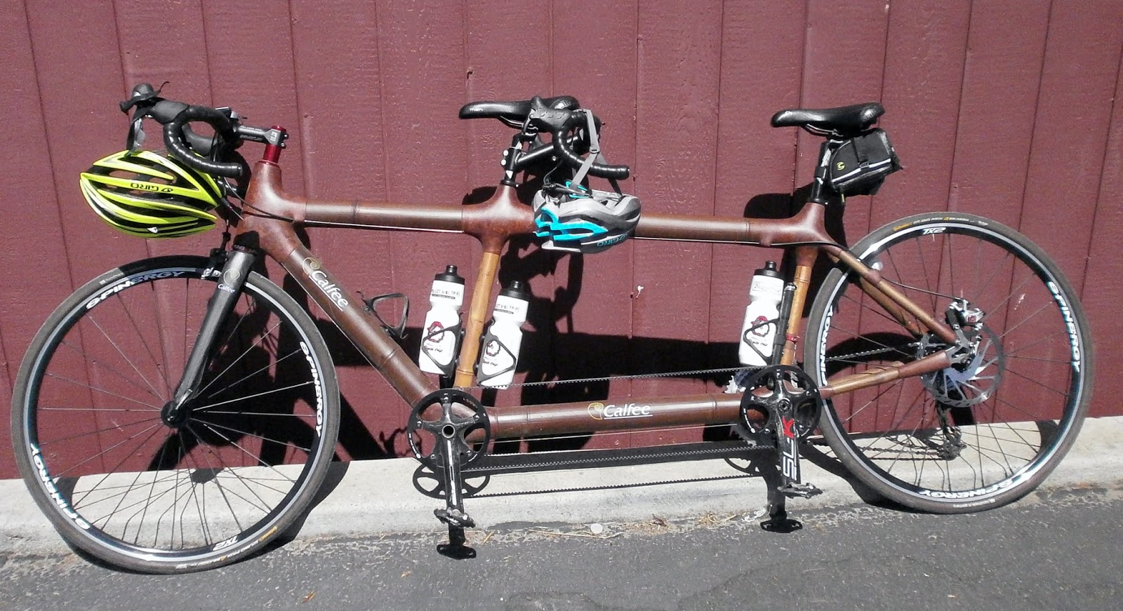
Bamboo tandem in Pescadero

Homage to Ward--Elliot will learn not to focus too long or strange things show up in the viewfinder

Highway 1 and Pacific on descent to Tunitas Creek Road

Christine happy finishing Tunitas Creek Road as she hasn't seen the idiot driving on the wrong side of the road yet.
Today Elliott and Christine go down first and Mike babysits me.  When we get down the the bottom we find out that Christine almost skidded out, as around a turn a car was full in in her lane coming at her.  She came out unscathed wit just a needless adrenaline rush.

Good deli sandwiches back in Woodside and then I took the long way back so I could go over the New Bay Bridge. (+pluses) Surrounded by spider web cables , nice view of the Oakland hills, bike lane/ pedestrian walkway.   (-minus) Uni tower is kinda dinky compared to the SF side Bay Bridge and Golden Gate Bridge towers, forest of thick floodlight poles looks strange.